This map displays the most recent summary streamflow values within the state of Washington from gauges maintained by the Washington State Department of Ecology and the United States Geological Survey (USGS). All data displayed are provisional and subject to significant change.
The following graphs are linked and displayed from the Washington Department of Ecology and the United States Geological Survey (USGS) websites.
USGS Site 13344500 near Starbuck
https://waterdata.usgs.gov/wa/nwis/uv?site_no=13344500
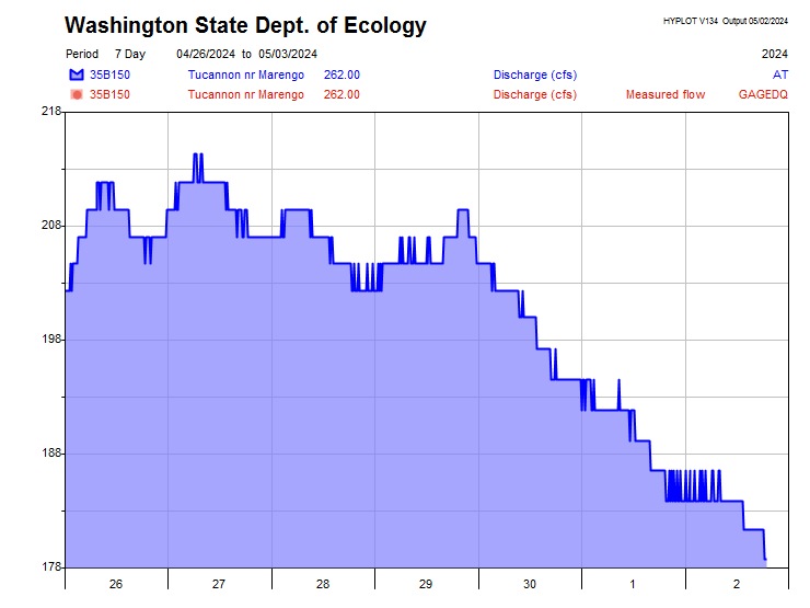
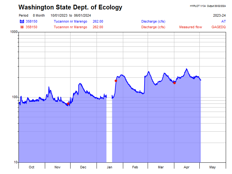
Washington State Department of Ecology Site 35B150
https://apps.ecology.wa.gov/ContinuousFlowAndWQ/StationDetails?sta=35B150